Papua-Neuguinea, 2023 – RV Sonne – Cruise SO299
Papua-Neuguinea, 2023 – RV Sonne – Cruise SO299
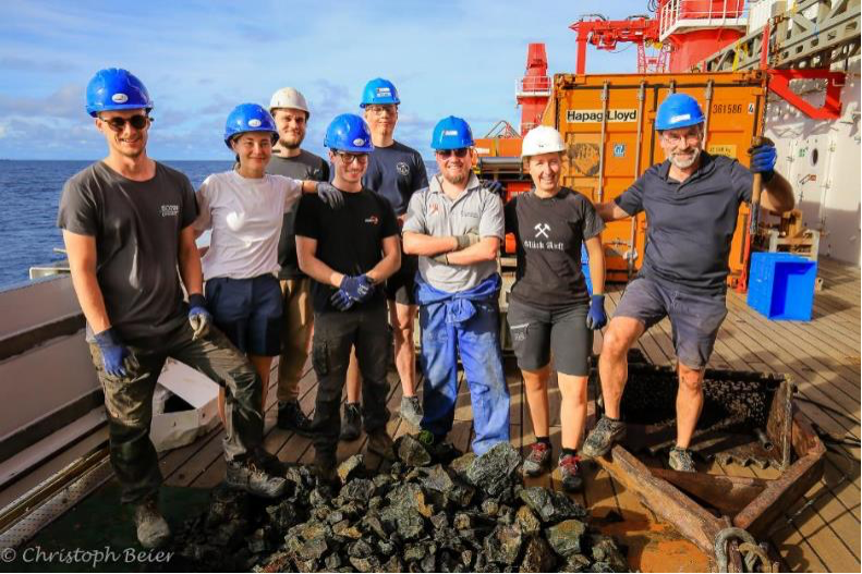
Under the leadership of two former Erlangen geoscientists, Dr. Philipp A. Brandl (GEOMAR Helmholtz Centre for Ocean Research Kiel) and Prof. Dr. Christoph Beier (University of Helsinki), the expedition with the German research vessel SONNE began on June 7, 2023, in Townsville, Australia. The goal is to investigate geological processes in the deep-sea region around Papua New Guinea that have led to the formation of some of the world’s largest copper and gold deposits. Participating from the GeoZentrum Nordbayern (GZN) are Jan Falkenberg (PhD candidate) and the two master’s students Julia Wenske and Egor Riemer.
Particularly in light of the ongoing controversy surrounding deep-sea mining, the expedition aims to refine ore deposit models and contribute to improved exploration and extraction of critical metallic resources on land.
More about this:
Cruise SO299 DYNAMET
GeoDYNAmics & METallogeny
Rifting of Island Arcs, Metallogenesis, and the Formation of Microplates: An integrated geodynamic, magmatic and hydrothermal study of the Bismarck Archipelago, Papua New Guinea
The diversity of metallic deposits in the Earth’s crust is closely linked to complex geological processes occurring at plate boundaries. Metal-enriched continental crust commonly forms along the intricate subduction zones of the western Pacific. In eastern Papua New Guinea, the growth of continental crust and the formation of metallic ore deposits are controlled by processes such as collisions between continents and island arcs, reversals of subduction zones, and continued metasomatism of the mantle wedge. These processes lead to the recycling and enrichment of volatiles and metals. Some of the world’s largest copper and gold deposits have formed in this region within the last 2–3 million years, and ore-forming processes are still active today. However, existing geodynamic models are too large-scale to adequately explain the links between magmatism, local tectonic conditions, and the role of the lithosphere.
Our project, which employs an integrated approach combining multibeam bathymetric mapping, seismology, electromagnetic methods, gravimetry, heat-flow measurements, geochronology and petrology/geochemistry, aims to develop, for the first time, a comprehensive model of this highly complex yet extremely The central unresolved question is: Why are metals so strongly enriched in the crust at this particular location?
Read more here …
Diving to the “Ore Factories” of the Deep Sea – SONNE expedition with ROV KIEL 6000 investigates ore formation in Papua New Guinea
Ann Kristin Montano communications and media
GEOMAR Helmholtz-Centre for Ocean Research Kiel
June 2, 2023/Townsville. Why does the Earth’s crust act like an ore factory in certain regions? An expedition with the German research vessel SONNE is heading to the Bismarck Archipelago in Papua New Guinea, home to some of the world’s largest copper and gold deposits. An international team of researchers is investigating the geodynamic processes that determine active ore formation on the deep-sea floor. During the voyage, led by Dr. Philipp A. Brandl, marine geologist at the GEOMAR Helmholtz Centre for Ocean Research Kiel, the ROV KIEL 6000 diving robot will collect samples and images.
The controversy surrounding deep-sea mining is highlighted by the current negotiations of the International Seabed Authority (ISA) on the legal framework for possible future exploitation. A growing number of countries, including Germany, are calling for a precautionary pause. Apart from the potential commercial activities, however, there is great scientific interest in mineral systems on the seabed: Only here can marine geologists directly study the active tectonic, magmatic, and hydrothermal processes that are important for the formation of many metal deposits that exist today. The scientific findings are used to refine deposit models and evaluate opportunities for improved extraction of energy-critical metals and metalloids from existing mines on land.
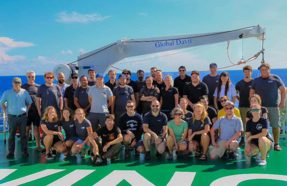
The SO299 DYNAMET expedition with the German research vessel SONNE is heading to the Bismarck Archipelago in northeastern Papua New Guinea to gain the first comprehensive overview of one of the most geologically complex and mineral-rich areas in the world and to try to answer an important unresolved question about this region: Why has so much metal accumulated in the crust at this location? The expedition is led by Dr. Philipp A. Brandl, marine geologist at the GEOMAR Helmholtz Centre for Ocean Research Kiel, Germany. Professor Dr. Christoph Beier from the University of Helsinki is co-leader of the expedition. The 37 participants also include researchers from the GeoZentrum Nordbayern at Friedrich-Alexander University Erlangen-Nuremberg (FAU) and the Federal Institute for Geosciences and Natural Resources (BGR). Researchers from the Universities of Ottawa and Toronto in Canada are also involved as part of a joint research and training project for marine geodynamics and georesources (iMAGE-CREATE), as well as the University of Papua New Guinea.
Sampling with state-of-the-art underwater robot technology
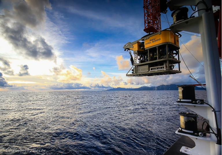
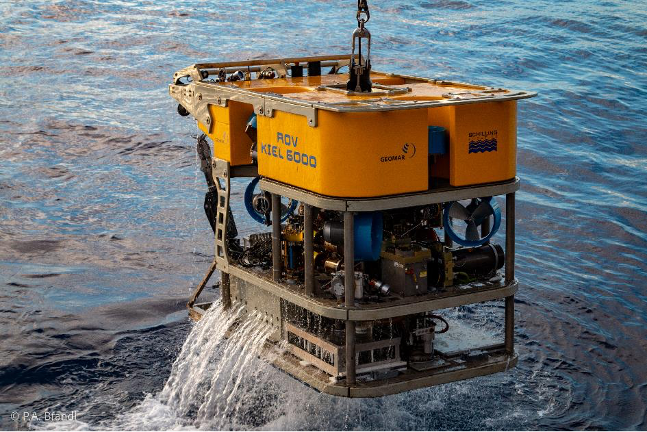
After a two-year delay due to the pandemic, this expedition will continue research work that began on three previous SONNE voyages in 1994 (SO94), 1998 (SO133), and 2002 (SO166). However, only during the SO299 expedition will state-of-the-art geophysical instruments be deployed on the seafloor to map the movement of magma and fluids in the crust, track active fault zones, and model the thermal structure of the crust. The central device is GEOMAR’s remotely operated vehicle (ROV) ROV KIEL 6000. The submersible robot can dive to a depth of 6000 meters and is equipped with high-resolution cameras, sonar, and a variety of sampling devices and in-situ sensors. The state-of-the-art system is operated by eight people and enables targeted and visually controlled sampling of individual rocks as well as liquid and gas outlets.
Metal deposits and hydrothermal vents
“The main goal of our research is to understand how plate tectonic processes can influence the formation of ore deposits near subduction zones. The region is of particular importance because some of the world’s largest copper and gold deposits have formed there and continue to form today,” explains Dr. Brandl. “We are interested in understanding how tectonic processes influence the location and size of mineral deposits. The interaction of seawater with the hot environment of the volcanically active seafloor is interesting because elements, including metals, are transferred from the underlying rock into the seawater and vice versa.” These regions are known as hydrothermal systems and are not only the scene of active ore-forming processes, but also hotspots of highly specialized biodiversity in the deep sea. “It is therefore part of our scientific responsibility to conduct research that is as non-invasive as possible,” adds Dr. Brandl.
Metals for green technologies
Demand for critical and special metals and metalloids is expected to rise steadily in response to the continued development and increased use of green technologies. “In order to meet the conditions for this growing demand while at the same time making the necessary supply of raw materials more responsible, the most suitable resources must be found on land and the efficiency of their use increased,” says Professor Dr. Beier from the University of Helsinki. “For us researchers in Finland, it is important to study ore formation processes in geologically young crustal blocks and in active systems in order to draw conclusions about the formation of geologically old deposits on land. Many of the mineral resources available to us in Finland may have formed in environments comparable to those in the western Pacific, so the present can be the key to the past.”
Expedition SONNE SO299 DYNAMET
06.06.2023 – 29.07.2023
Townsville (Australia) – Singapore
Further information:
http://www.geomar.de/n8968 Images available for download
https://www.geomar.de/en/so299 Expedition SO299 DYNAMET
- Weekly report 1
- Weekly report 2
- Weekly report 3
- Weekly report 4
- Weekly report 5
- Weekly report 6
- Weekly report 7
- Logbook of participants from Erlangen (see below)
- Ocean Blogs
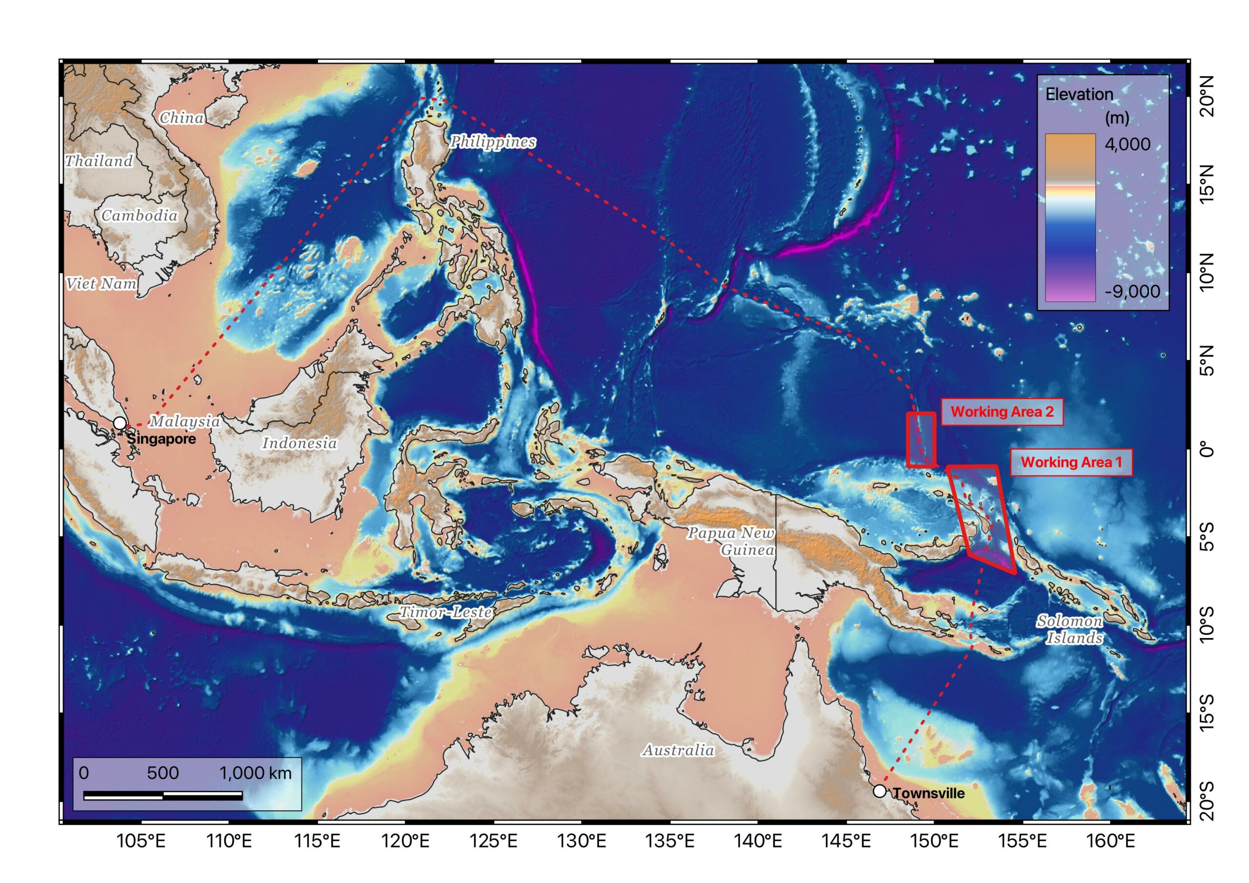
Planned route
Cruise SO299 DYNAMET
Start: 6. Juni 2023 in Townsville – Australia
End: 29. Juli 2023 in Singapore
53 days at sea, including 36 working days
Trip management: Dr. Philipp A. Brandl, GEOMAR
Our team on board
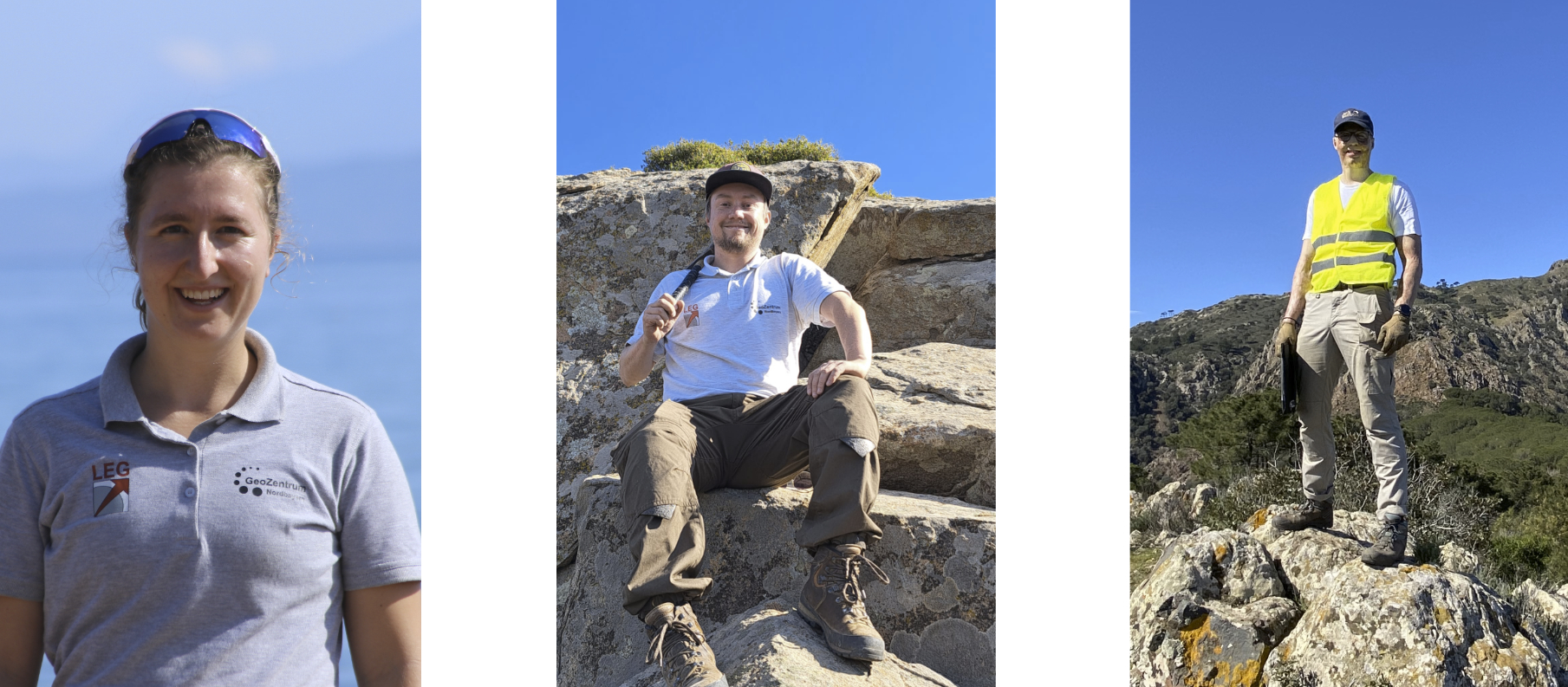
Julia Wenske — Jan Falkenberg — Egor Riemer
The Chair of Endogenous Geodynamics at the GeoZentrum Nordbayern, headed by Prof. Dr. Karsten Haase, is sending three research assistants on the expedition:
- Jan Falkenberg is a doctoral student researching the isotope and trace element geochemistry of hydrothermal mineralization in submarine hydrothermal systems (“black smokers”) in the western Pacific and subaerial porphyry epithermal deposits in Greece.
- B.Sc. Julia Wenske will write her master’s thesis on some of the rock samples from this expedition and investigate the magmatic evolution of various submarine seamounts. In her bachelor’s thesis, Julia researched helium and carbon isotopes from springs and mofettes in the Eger Graben.
- B.Sc. Egor Riemer is writing his master’s thesis on hydrothermal mineralization at the world-class copper-molybdenum deposit SarCheshmeh, Iran. During his bachelor’s thesis, Egor researched the geochemistry of hydrothermal fluids and chalcopyrite in “black smokers.”
- Dr. Christoph Beier (now at the University of Helsinki in Finland) is particularly interested in magmatic processes that take place at subduction zones and the associated back-arc spreading axes. On this expedition, the lavas and the xenoliths they contain are of particular interest.
Logbook of the expedition
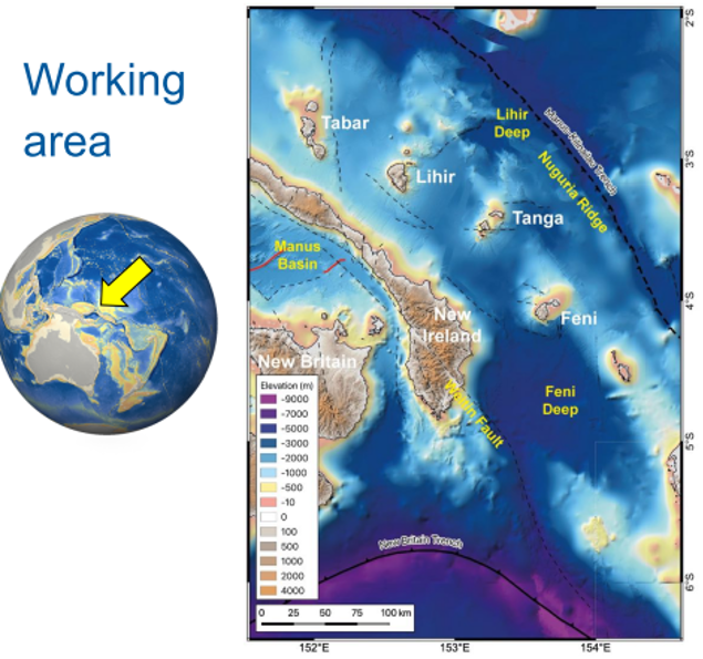
In June/July 2023, a group of geologists from Erlangen (M.Sc. Jan Falkenberg, B.Sc. Julia Wenske, and B.Sc. Egor Riemer, led by Chief Scientist Dr. Philipp Brandl (GEOMAR) and Co-Chief Scientist Prof. Dr. Christoph Beier (FAU/University of Helsinki), will embark on the SO299-1 expedition with the German research vessel Sonne to the Bismarck Archipelago in northeastern Papua New Guinea. The 36-member international team of scientists will investigate the tectonic features of island arc-associated basins, the metal enrichment of magmas and metallic mineralization, and the development of oceanic microplates in one of the most geologically complex and mineral-rich areas in the world. The expedition will start in Townsville (Australia) and end in Singapore after approximately 53 days at sea. Using state-of-the-art technology and a combination of geophysical and geochemical methods, the team will attempt to understand the relationship between tectonic processes and the enrichment of metallic raw materials in subduction zones.
Log 6: Almost over – Transit and Container Tetris Challenge
The start of the transit journey is marked by hustle and bustle in the laboratories and on deck. All scientific material must be sorted and carefully stowed in boxes and on Euro pallets in the large containers. Pallets, boxes, large equipment Tetris is the order of the day. In addition, the official departure report must be prepared, in which all methodologies and initial results must be documented.
However, there is still plenty of time to relax after work and enjoy a wide range of leisure activities. The program includes movie nights, video game tournaments, and a varied sports program (e.g., kickboxing, circuit training, yoga, ballet, and much more). In addition, the table tennis tournament, which has been running since the first week on board, is entering its final round.
In addition to leisure activities, a series of scientific lectures will also be organized. We will listen to presentations from various working groups in order to discuss new findings, learn about new methodologies, and coordinate future work.
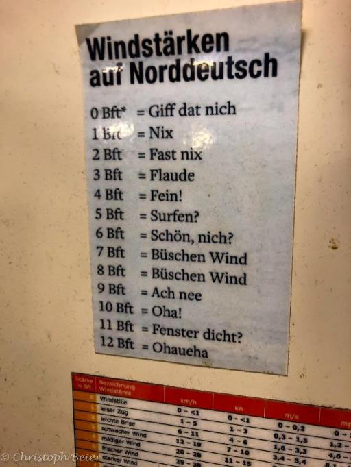
As usual, however, plans can change at short notice. The planned transit route north past the Philippine Islands and then south again to Singapore is hit by a storm. Weather models and the watchful eye of our captain detect the possible development of a typhoon on our northern transit route. Accordingly, the course is changed and one of the alternative routes is used. We are now steaming directly west and will make our way to Singapore through the Celebes Sea and Sulu Sea. Despite the change in route, we are caught in the tail end of the storm and have several days of significantly stronger winds and rougher seas than in the weeks before…which upsets some people’s stomachs, but also fulfills the expectations one should have of the high seas in the middle of the ocean!
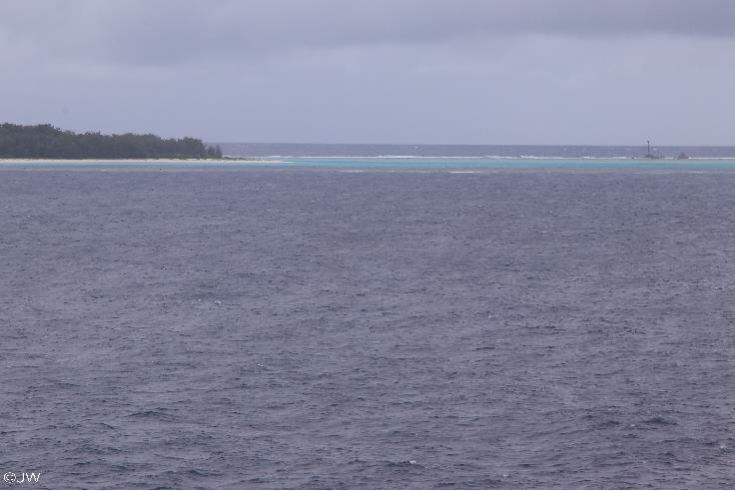
The laboratories are spotless, the laboratory refrigerators tidy! The last week on the SONNE begins with the belated mid-term celebration. At the same time, it is also the farewell of a long-standing crew member, who is given a ceremonious send-off into well-deserved retirement with a small performance and gifts. There is a barbecue, chatting, and a review of the last few weeks. Meanwhile, the first atolls and islands are appearing between the Philippines in the north and Malaysia in the south. It’s been a little strange to be here without ever setting foot on the neighboring land.
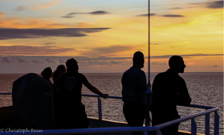
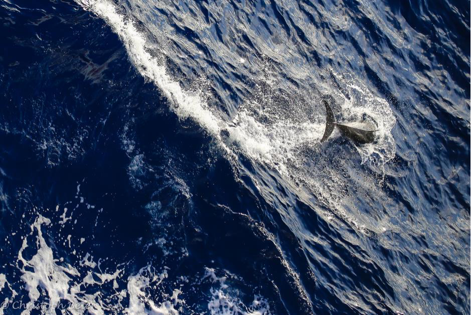
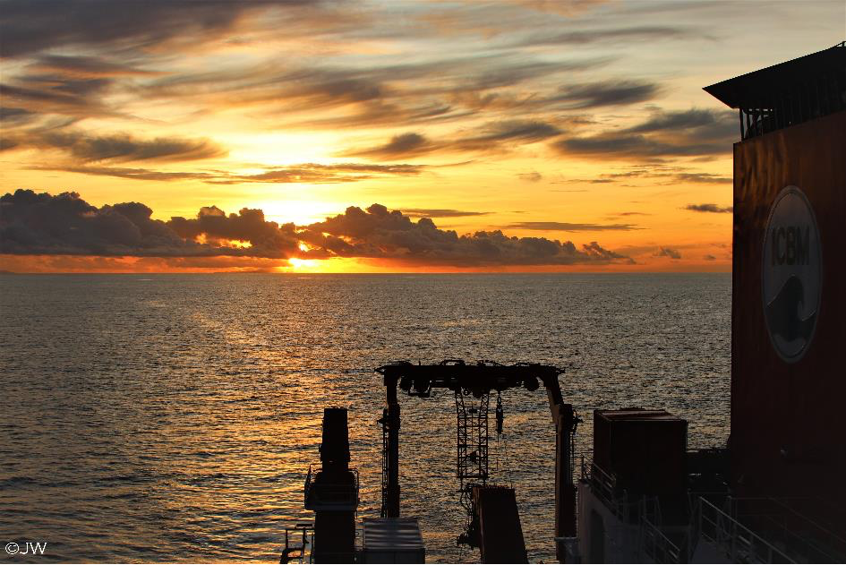
In the evening hours, the observation deck is the ultimate attraction for anyone who wants to enjoy the impressive cloud formations and sunsets. The dolphins caused quite a stir as they hunted and curiously explored our ship, jumping in the bow wave.
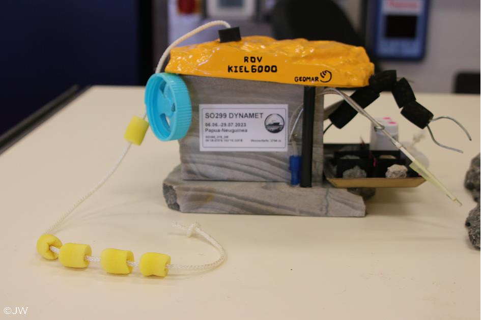
To thank the crew for their fantastic cooperation, the scientists got creative and made a small gift. A replica of the ROV Kiel 6000, consisting of the rock samples collected and various laboratory materials, now adorns the display case in the lounge and serves as a reminder of the SO299 expedition!
On our last evening aboard the SONNE, we all spend time together in the ship’s hangar. The Singapore skyline is already visible on the horizon, and we will enter the harbor early in the morning. With these words, the SO299 expedition led by Dr. Philipp Brandl (Geomar) and Prof. Dr. Christoph Beier (University of Helsinki/FAU) comes to an end. Many thanks to the entire crew of the Sonne for giving us such a wonderful time on board. Without you, it would not have been possible!
Many thanks also to the entire scientific crew, who became new friends during our eight-week expedition. The first plans for private get-togethers are already in full swing—for example, part of the team is spending several days in Singapore, another part is traveling together to the Indonesian island of Lombok for a week, and a post-cruise meeting is already scheduled for some of the team at Geomar in Kiel. This is what makes research and networking fun!
The Erlangen SO299 Team,
Jan, Julia and Egor
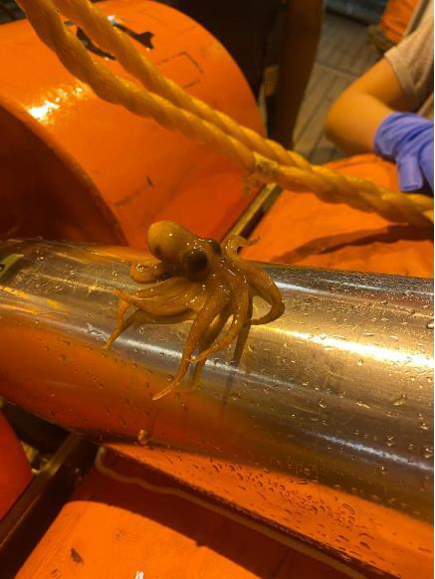
Log 5: Time to surface – Occy in love
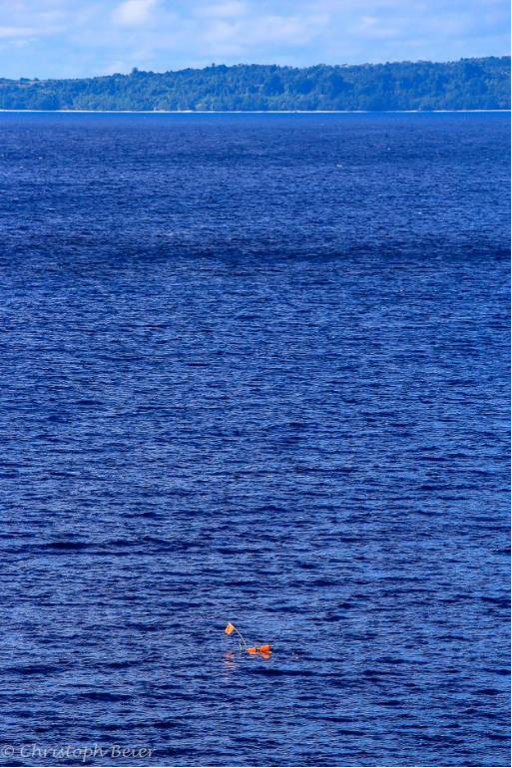
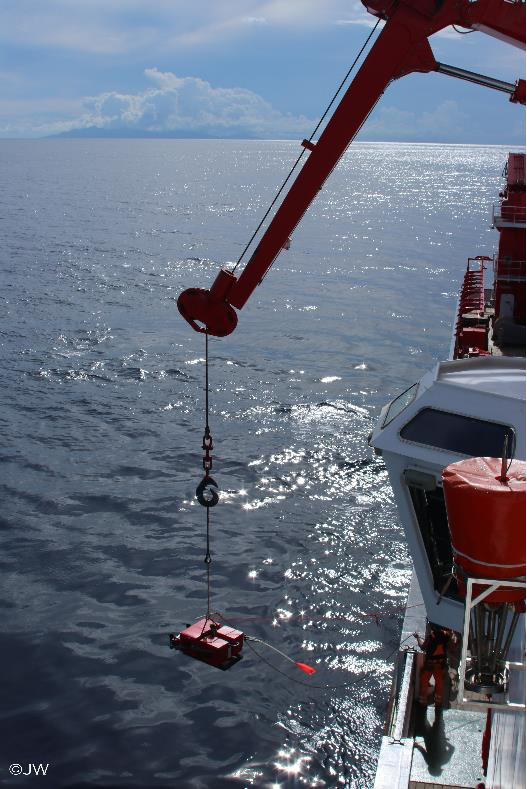
After almost four weeks, it is time to collect the OBS and OBMT devices again. The individual releasers are pinged using sound pulses with a specific frequency. Once contact has been successfully established, the device releases its anchor and rises independently to the sea surface. The FS Sonne is already waiting there, and the deck crew begins to retrieve the devices by throwing a hook attached to a rope. They are then hoisted on board by crane, the data is read out, and the devices are securely packed in a container for the journey home.
The spider-shaped OBMTs were probably mistaken for a relative by a small octopus. Clinging to its cousin, this octopus (“Occy”) began its journey from the sea floor to the deck before being allowed back into the cool water.
Following successful OBM and OBMT fishing, there are now two ROV dives, four TV grabs, and a few dredges left to complete the observations and sample list at the various locations. Gaps in the multibeam mapping of the seabed will also be filled in order to obtain a complete data set for the region.
The officially last stop in the SO299 exit work area has been completed! From Ankaramit to Xenolith, the Petrology Team collected, documented, and described 446 individual rock samples. A complete success!
During our 14-day transit to Singapore, the first scientific publications from the various working groups are already being discussed and planned. In addition, the equipment must be packed and the laboratories cleaned for the next trip. After this phenomenal expedition, the scientists now have a lot of laboratory and computer time ahead of them once they return to their respective research institutions. Many of the rock samples will be examined for the slightest concentrations of elements such as Au and Ag, but also for rare earth elements. The geophysical data will be converted into images of the oceanic crust and sediment layers using complex algorithms. The combination of geophysical, hydroacoustic, and geochemical methods will enable scientists to better understand the geotectonic and geochemical history of the region and make a valuable contribution to our understanding of magmatic and hydrothermal systems in subduction zones.
Log 4: Playing with Fire and Payday
Another safety drill is scheduled. During the test alarm, the scientific team must assemble at the muster station within a few minutes wearing life jackets, headgear, and long clothing. Then a head count is taken. For the exercise, everyone on the aft deck is allowed to hold a fire hose and adjust the different water jet patterns. Meanwhile, the crew practices what to do in case of fire! All crew members are involved and assigned specific tasks. Safety on board the Sonne is the top priority.
The days blur into one another. Instead of weekdays, only the date or station number (and which device is being operated) determines the daily routine. During the day, TV grabs and ROV dives are mainly carried out, and at night, fan echo sounder mapping, heat flow measurements in the sediment, and rock dredging are performed.
The team is now in the southern working area near the Weitin fault. A full dredge (approx. 300 kg) yields a variety of different rocks from the tectonically active area. Within the fault zone, we find heavily brecciated and metamorphically altered rocks that we had not expected to find in this form. This means that the initial routine of rock description (mainly basalts) is expanded to include new textures, minerals, and rock types. This requires us to recall the various rock classifications from the basic courses of our studies.
After several days in the southern working area, we head back north to the underwater volcanoes around Lihir Island. A phenomenal dive to the newly discovered Karambusel (Tok Pisin, the regional language of Papua New Guinea for shell) hydrothermal field has something for everyone. We collect fresh basalt rocks, warm fluids, mineralizations, and observe lots of deep-sea creatures.
One highlight of the past few days was the tour of the machinery, organized by Chief Engineer Achim (often referred to on board simply as “the Chief”). He showed us the engine rooms, the control center, the winch room, and much more. Without him, we would definitely have gotten lost in the labyrinth of pipes, motors, and equipment, but we’re not allowed to go down there on our own anyway. It’s amazing what technology and logistics are hidden behind the scenes. For the safety of the crew, the purpose of the dead man’s alarm was also explained to us. The respective technicians have to confirm at regular intervals that everything is in order below deck. At this point, we would like to thank Achim for his patience, his answers, and the earplugs! We get the feeling that this ship can do absolutely EVERYTHING. However, everything only works because the engine and technical crew take care of it 24/7 and nurture and maintain the SONNE.
In the evening, steward Bernd is waiting for us to settle our bills at the canteen, the ship’s “shopping mall.” Several times a week, it is possible to buy additional snacks, souvenirs, toiletries, and soft drinks. Bills are settled at the end of the month—and that time has now come. None of us have had any cash in our hands for a month, let alone euros. Once again, we are reminded of the comprehensive care we enjoy here!
It is unofficially halfway through the trip, i.e. we have reached the halfway point of the voyage. Unofficial because work will continue as usual due to the delayed start of operations and the celebrations will be postponed. The long transit to Singapore leaves plenty of time to catch up on the celebrations. Work first, then pleasure is the motto. According to the current plan, after a 14-day transit, the sun will rise in Singapore on the morning of July 29.
Today, dredging at depths of up to 5,500 meters is on the agenda. When searching for rocks at such great depths, there is a relatively long idle time between work steps. It takes almost two hours for the dredger to reach the seabed at a speed of 1.0 m/s. Then there is an hour of slow travel and laying out the cable on the dredging route. This is followed by an hour of slow hoisting across the seabed. Only then does the radio message sound through the loudspeakers: “Winch for lab” – “Attention – the winch” – “Please hoist to deck at 1.0!” – “To deck at 1.0!” – “Thank you!” Then it’s another 2 hours of waiting until, hopefully, a full load of rocks from the cool water sees the sun. The tension rises, while there is still time for a round of table tennis in a 2 vs. 2 table tennis tournament on board!
Log 3: Routine at sea
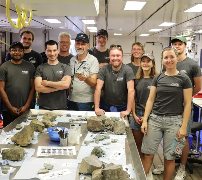
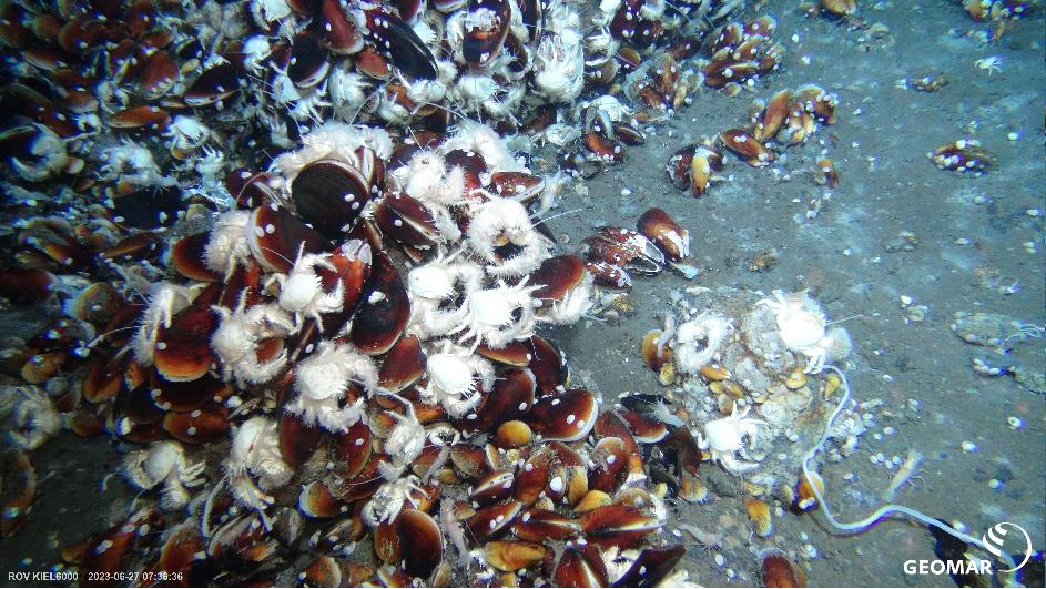
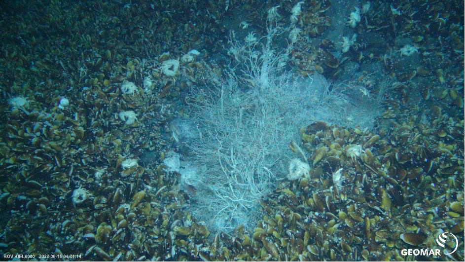
Today’s schedule is all about the first ROV Kiel 6000 dive on this research trip. During the 10-hour underwater expedition to the flanks of the Conical Seamount volcano, most of the scientists are sitting together in the conference room in front of the screens. The moving images in HD reveal a phenomenal underwater world, some of which is just bursting with life. Mussels, crabs, squids, sea lilies, snails, sea cucumbers, corals, fish, shrimp, and other animal species in many colors and sizes cavort in the sediment and between the volcanic rocks. The petrologists on board are mainly interested in igneous rocks and mineralizations, as they can use their major and trace element and isotope composition to discuss the history of the volcano’s formation and the processes of metal enrichment. The entire dive is recorded and logged in detail. Selected rocks are sampled with the gripper arms and later described in detail on board. The petrology team led by Jan, Julia, and Egor (GeoZentrum Nordbayern) and Leon, Johanna, and Louis-Maxime (GEOMAR/University of Kiel) works on the samples until late in the evening under the direction of Thor Hansteen (GEOMAR). Sorting – photographing – sawing – photographing – describing – microscoping – logging – digitizing – packing! The samples, some of which weigh several kilograms, are carefully processed. For scientists, every rock sample is worth its weight in gold!
Further ROV Kiel 6000 dives are planned for the coming days. After the third dive at the Edison underwater volcano, the team has already become very familiar with the work processes and sample processing is proceeding quickly and systematically.
Between shifts and during transit, there is always time to relax and play table tennis, darts, or board games. The ship’s fitness room is equipped with bicycles, rowing machines, and weights for athletic training. Afterward, you can relax in the sauna to start the next workday feeling refreshed.

In addition, some of the scientists regularly get together for joint sports programs. Among other things, there have already been yoga, kung fu, circuit training, and disco fox classes.
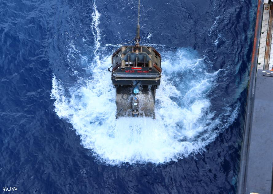
Under the direction of Christoph Beier (University of Helsinki) and the WTD team from Sonne (Scientific Technical Service), large quantities of rock material are being lifted from the seabed using the TV grab. The TV grab is a large, hydraulically and electrically operated excavator bucket that is lowered vertically to the seabed. The grabber is equipped with lamps and a camera, which enable observation of the seabed. With skill and sensitivity, this 2-ton pendulum is lowered to a depth of 1500 m to specifically sample a large quantity of magmatic rocks. This would not be possible with the diving robot, as the buoyancy of the ROV is limited. In addition to rock fragments, we also collect a lot of deep-sea mud – shoveling and sifting sediment is the order of the day so that even the smallest valuable rock material can be found. There is a lively gold rush atmosphere in the team as everyone tries to get their hands on the most beautiful and freshest (unweathered) rock fragments or any volcanic glass.
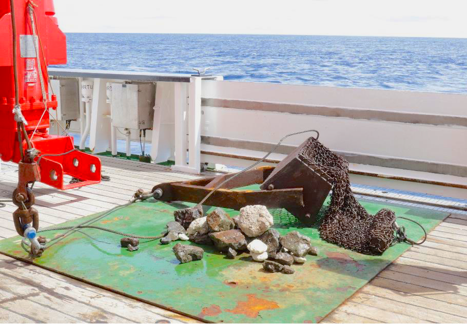
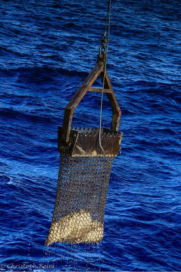
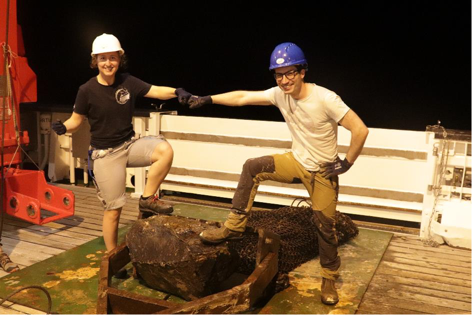
The Sonne’s ship and research operations run 24/7. At night, the next day’s work area is often mapped out. Tonight, however, the focus is on dredging. This involves dragging a 1.5 m wide and 3 m long metal bag attached to an open metal box with teeth several meters across the seabed. The principle is simple. Loose rocks end up in the belly of the steel monster, and some larger chunks are loosened from the sediment. After an empty first round, the second dredge brings an approx. 200 kg basalt block and several smaller magmatic rocks onto the deck. A complete success! The boulder is broken up with a sledgehammer and the fragments are sawn, sorted, described, and packed. Another success for the crew and the scientific team, because before this discovery, a mud volcano was expected at this location, not a magmatic volcano.
While scientific work continues around the clock, the crew and scientists are of course also provided with continuous culinary care. Two cooks and three stewards warmly look after the well-being of the entire ship’s crew and scientific crew. In the morning (7:00–8:00 a.m.), there is a rich (hot) breakfast buffet, and at lunchtime (11:30 a.m.–12:30 p.m.) and in the evening (5:30–6:30 p.m.), hearty hot vegetarian or non-vegetarian meals are served, as well as a salad buffet and snacks.
Today is Thursday – Seaman’s Sunday. Breakfast consisted of freshly baked rolls, pancakes, fried eggs, croissants, Bremer Knipp, as well as cheese, sausage, jam, and fresh fruit. Lunch will feature ox cheeks, potatoes, dumplings, spinach and feta dumplings, salad, and ice cream for dessert. With our bellies full and our spirits high, the workday begins after refueling in the mess hall – quickly swallowing the last bite and changing into our work clothes, because the next (hopefully full) dredge will be on deck in 10 minutes.
Log 2: Research begins
After some initial difficulties, Papua New Guinea observer Stanis Konabe arrived by pilot boat this morning. This means that the ship’s crew is now complete and nothing stands in the way of departure for the work area – if it weren’t for a small technical problem with a hole in the ship! In the hangar, a large weather-protected work area, there is access to the so-called pilot shaft, a hatch in the hull of the ship that allows access to the sea. This enables scientific equipment, for example, to be deployed without being affected by wind and waves. While testing the Sonardyne underwater navigation system for the ROV Kiel 6000 diving robot, the lowering plate in the shaft got stuck and is now jammed! Now we have to wait until the sounding shaft is closed again – because it’s not easy to navigate with the shaft open. At the same time, the diving robot is undergoing a short technical test run in the shallow waters of the bay off Townsville – everything is working perfectly.
Thanks to our fantastic crew, we set off at around 8 p.m. (with the pilot shaft closed) and head for Papua New Guinea at a speed of 10 knots.
The daily scientific meeting, led by Chief Scientist Philipp Brandl, provides information about the current situation on board. Unfortunately, formal confirmation of the research permit for the waters of Papua New Guinea is still pending. Without this, we cannot map, take geophysical measurements, or collect rock samples. This naturally dampens the mood somewhat.
Mild seasickness among some of the scientific crew does not make the situation any easier. Winds from the southeast with speeds of 5 to 6 and swells of 2-3 meters from the southeast hit the starboard side of the Sonne. Especially in the cabins on the lower decks, the waves sometimes reach the portholes and form a whirlpool.
But the highlight of the day is still the “anchor party”! Anchor weights have to be bolted together for the 18 ocean bottom seismometers (“OBS”) that will be deployed on the seabed at the start of the voyage. Physical activity, bolting work, social interaction, and fun guaranteed! Approximately 20 scientists work in teams of four to screw the iron parts together to make anchors weighing around 50 kg.
Despite the lack of approval, everything is already being prepared for scientific operations so that work can begin immediately upon receipt of written confirmation. Geophysical instruments are being calibrated, work procedures discussed, and analog and digital documentation set up. The be-all and end-all of scientific work is accurate observation and documentation so that researchers who are not directly on board can continue to research the observations later.
In the evening, the ship’s steward opens the canteen and you can stock up on sweet and savory snacks, toiletries, and SONNE merchandise to your heart’s content. A great reward for a day’s work! Some scientists proudly wear the T-shirts with the FS SONNE logo immediately after purchasing them.
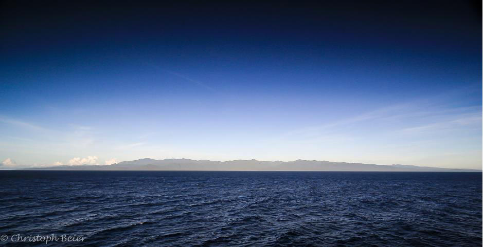
At around 9 a.m., we pass the Joma Entrance and observe several reefs and islands in Papua New Guinea’s Milne Bay Province. We are accompanied by several cargo ships, as we are currently on one of the main shipping routes between China and Australia.
After lunch, James Taylor from the ROV (Remote Operated Vehicle) team gives a presentation on the ROV Kiel 6000 diving robot, which we can use to sample up to 20 rock pieces at depths of up to 6000 m using mechanical gripper arms. The samples and observations made with the ROV are particularly valuable scientifically, as the HD and 4K cameras allow us to see directly onto the seabed and take very specific samples. Furthermore, there are no high-resolution moving images of the seabed in this area of work yet – so this is completely new territory and no one knows exactly what to expect!
As the team is still awaiting official confirmation of the research permit for Papua New Guinea’s national waters, the SONNE is steadily steaming towards New Ireland at a slightly reduced speed (6 knots).
The time spent in transit is used to familiarize those who are participating in a research expedition for the first time with the various research equipment.
We are now sailing parallel to New Ireland in a northwesterly direction. Still no update on the research permit. The working area, the area around Lihir Island and the submarine volcanoes Tubaf, Edison, and Conical Seamount, is already visible on the horizon.
2:00 p.m.: Finally! The email arrives with the fresh signature on the official permit for research on the seabed in the waters of Papua New Guinea. Euphoria on board!
Events are unfolding rapidly and there is a flurry of activity on deck and in the laboratories. The first task is station planning, i.e., deciding which scientific activities will take place in which order and at which position (station). Then, once we are in deeper waters (approx. 2500 m), the release mechanisms (releasers) for the OBS (Ocean Bottom Seismometer) and OBMT (Ocean Bottom Magneto Telluric) instruments will be tested. These mechanisms will later be used to release the devices from their anchors on the sea floor and return them to the sea surface. Using CTD (Conductivity – Temperature – Depth measuring device), sound wave velocity profiles in the water column will be measured to enable accurate mapping of the seabed with the Multibeam Echo Sounders System using sound wave pulses. Depending on the settings and water depth, accurate mapping with a resolution of up to approx. 20 m is possible in a fan-shaped area below the ship.
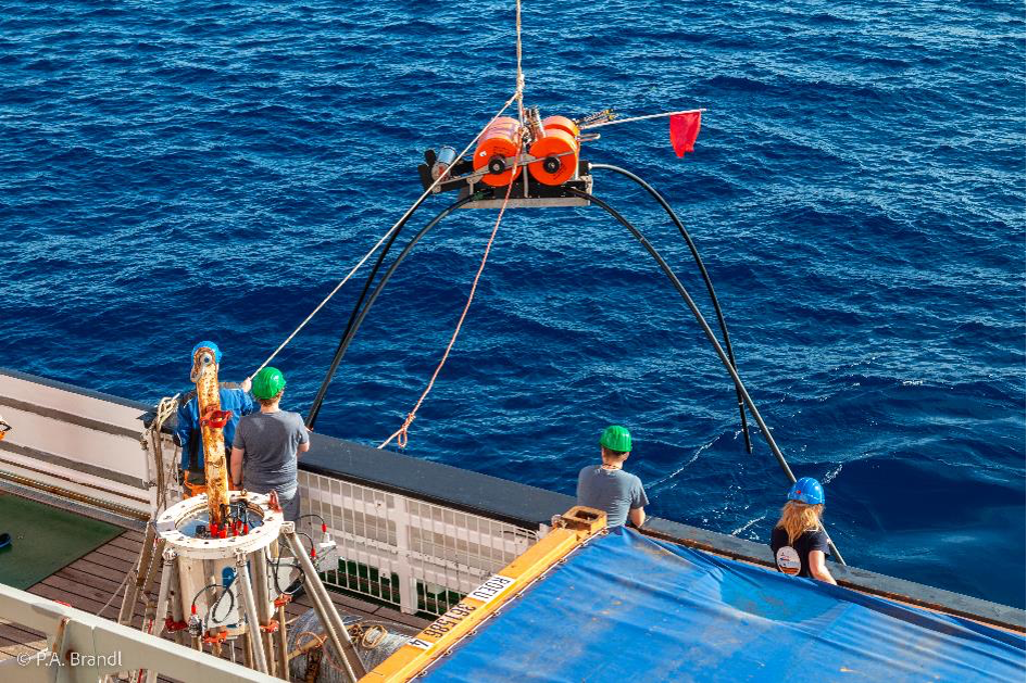
At 12:00 noon sharp, we reach the first station for deploying the OBS and OBMT devices. These highly sensitive geophysical measuring instruments will be deployed on the seabed at various locations around Lihir Island until the end of the research expedition, recording seismic waves and local magnetic fields. The team hopes that this data will provide insight into the seabed. It may reveal different types of rock, tectonic structures, and possibly even pathways for hot solutions deep within the Earth’s crust. After about four weeks, the devices will receive an acoustic signal instructing them to release their anchor weights and rise to the surface on their own. If everything goes according to plan, we will be waiting at the same location to hoist the devices back on board.
Log 1: expedition start
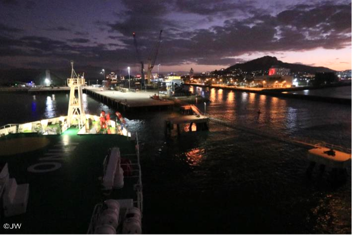
After months of planning, it’s finally time to go! Jan and Egor have a 28-hour journey ahead of them to Townsville (Australia), with stopovers in Doha (Qatar) and Brisbane (Australia). Julia has already been in Australia for several weeks. The scientific and technical equipment for sampling, documenting, and storing the valuable rock samples from depths of up to 3,000 meters has been on its way to Townsville by container ship for two months and should arrive at the port in Australia in the next few days. The research vessel Sonne will dock in the port of Townsville on June 2, and preparations for unloading equipment and samples from the previous scientific expedition and reloading supplies are already in full swing.
The eight-hour time difference is taking its toll. Jet lag is getting to all the participants. Nevertheless, we take a short trip to a nearby reserve for native animal species to experience some of Australia’s nature. In the evening, we meet Chief Scientist Dr. Philipp Brandl and Co-Chief Scientist Prof. Dr. Christoph Beier on site. With temperatures of 28°C and 90% humidity (and jet lag), the day passes quickly, as if in a dream.
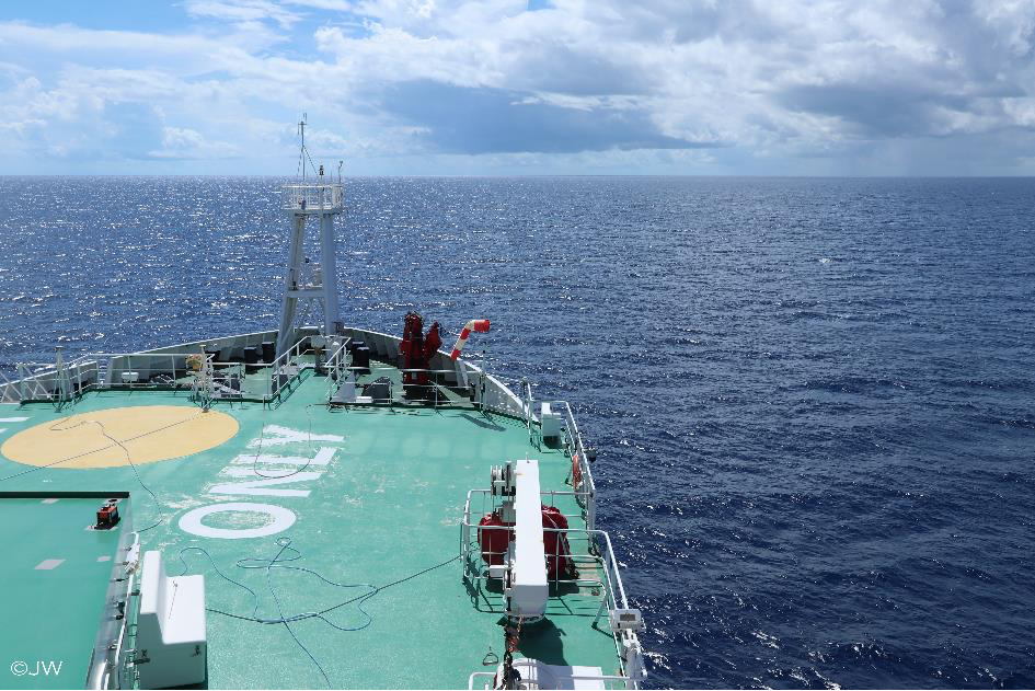
Preparations are already in full swing on the FS Sonne. But the students still have some time left to enjoy solid Australian ground beneath their feet before setting sail tomorrow for 53 days on rolling seas. The team is taking a short trip to nearby Magnetic Island to enjoy the beauty and uniqueness of Australian nature. The island is reached in just 20 minutes by ferry. White sandy beaches, palm trees, (sub)tropical jungle, and exotic island inhabitants whet the appetite for more. The palm tree under which we sip our cocktails will be the last green we see for a long time – except, of course, for the paintwork on the ship’s deck (classically green so that the deck contrasts optimally with the blue sea) and the plants on the bridge of the Sonne.
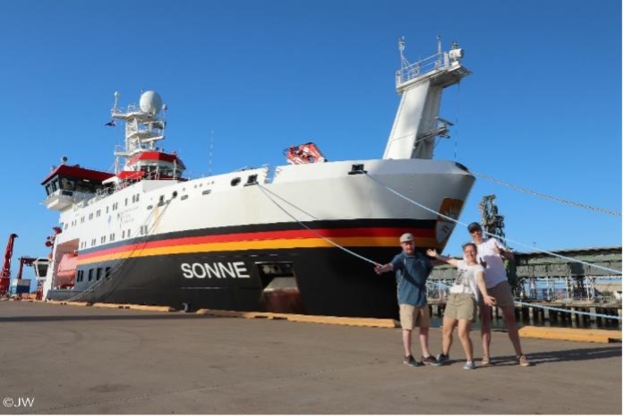
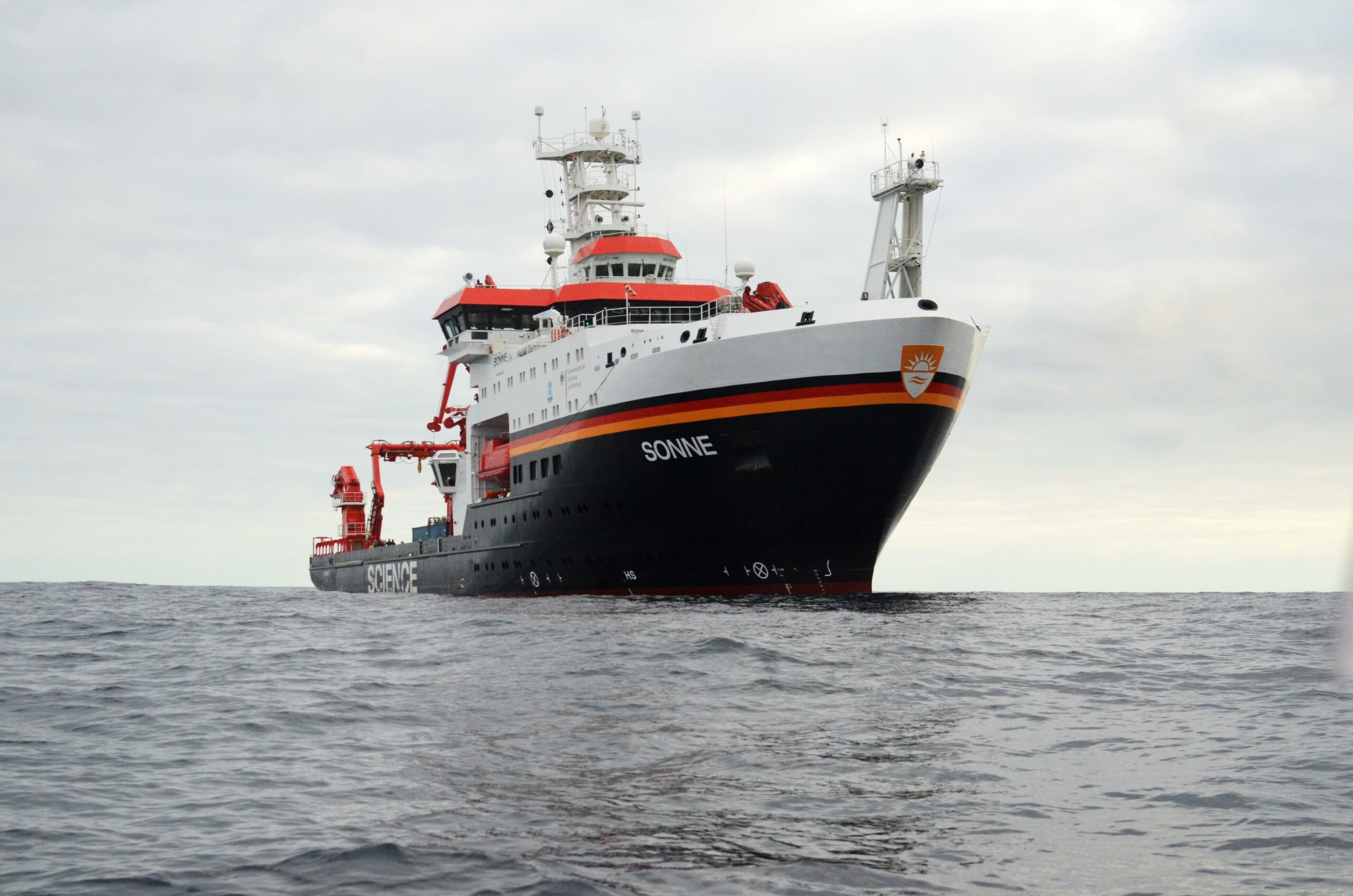
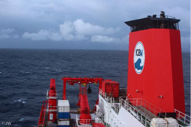
After a quick breakfast near the beach, we take a shuttle bus to the harbor district in the early hours of the morning, where the Sonne is already waiting for us. Red, yellow, black, and white, freshly painted, one of the most modern research vessels in the world stands out clearly from the surrounding gray container ships and cutters. With a length of 116 m and a width of 20 m, the Sonne is the flagship of the German research vessel fleet and can provide a home at sea for up to 35 crew members and 40 scientists for two months. State-of-the-art technology enables scientific work to be carried out in eight laboratories covering an area of 600 m². The Sonne’s main area of operation is in the Pacific and Indian Oceans.
The first night in our own small but chic and functionally furnished cabin is over. The first item on the agenda is the safety briefing for living and working on the ship. During the tour of the various decks, the escape routes, lifeboats, and general safety precautions are explained. Afterwards, there is already a lot of activity on deck and in the laboratories. The laboratories are set up, technical equipment is checked, and everything is securely packed and fastened against the waves. At 3:00 p.m., the first scientific meeting takes place in the conference room. In the 50 m² room, Phillip Brandl explains the procedure for the next few days after a short round of introductions.
Problems with arrival! – The last member of the scientific team – an observer from Papua New Guinea, whom we want to have on board because we intend to work in the country’s exclusive economic zone – is having problems arriving, but the ship has to leave port… Despite a slight delay, the Sonne leaves port at 6 p.m. at sunset and heads for the horizon. After a two-hour journey, we reach our anchorage position and are now lying at anchor there – awaiting the arrival of the last participant, who is to arrive from the mainland by pilot boat.